Official tourism website for Northern Ireland
En

Castlewellan Forest Park - Slievenaslat Walk

Co Down
Castlewellan Forest Park - Slievenaslat Walk

Book Tickets Online

About

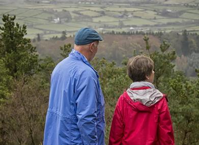
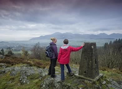
This steep climb through the forest provides a series of viewpoints offering panoramic views of the Mourne Mountains and surrounding drumlin landscape of Co Down.

Start Point:
J335364

Finish Point:
J335364

Route:
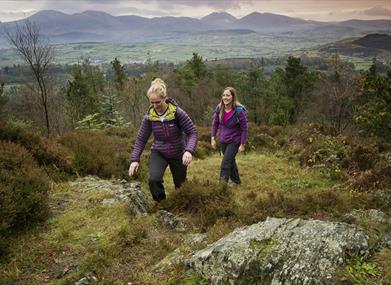
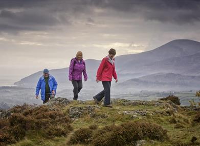
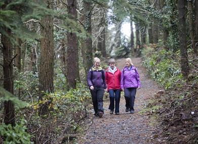
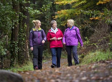
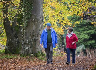
Part of the new Castlewellan Walking Trails launched in November 2014, this trail is signposted from the Lakeside car park - follow the yellow waymarkers. Starting at the Lakeside Car Park, follow the north side of the lake before starting the steep climb to the summit of Slievenaslat (272 metres).  Openings within the forest and the summit itself provide panoramic views of the Mourne Mountains and the drumlin landscape of Co.Down before commencing your descent. The most strenuous walk in the Park, this trail is rocky in places with steep gradients and numerous steps both up and down. Variable and uneven trail surfaces are present including large loose material including rocks and roots. This walk is situated in a working forest environment and may be subject to diversion and closure from time to time. Up to date information is available on the Forest Service web site - link below.

Distance:
2.7 miles

Terrain:
Strenuous including steep climbs

Point of interest:
Views of the Mourne Mountains, Castlewellan Castle, lake and gardens

Facilities:
Car park (fee charged), café, toilets (disabled access), picnic areas, The Peace Maze, Activity Centre, lecture room/ classroom, camping & caravaning, orienteering route, mountain bike trails.

Nearest town:
Castlewellan

OS map:
Sheet 29

Accessible toilet facilities:
Yes

Accessible terrain:
Level paths, steep in places, last section to hill summit narrow and rocky in places

Book Tickets

Facilities

Provider Preferences

  • Free (parking charges may apply)

Map & Directions

What's Nearby

  1. Castlewellan Peace Maze, is one of the world's largest permanent hedge mazes representing…

    0.13 miles away
  2. Castlewellan Forest Park boasts a stunning Victorian Castle, incredible panoramic views,…

    0.6 miles away
  3. Covering an area of almost 630 hectares at the foot of the Mourne mountains, Tollymore…

    2.44 miles away
  4. Maghera Church and Round Tower is of major historical importance and is among many…

    2.63 miles away
  5. Murlough National Nature Reserve is a fragile 6000 year old sand dune system owned by the…

    4.02 miles away
  6. Set in spectacular surroundings overlooking Dundrum inner Bay these fine Georgian…

    4.05 miles away
  7. Sand & pebble beach located on the south down coast.

    4.1 miles away
  8. Believed to have been built in or around 1177, Dundrum Castle was built by John De Courcy…

    4.23 miles away
  9. This 5 mile stretch of golden sands is still the essence of the resort and is hugely…

    4.32 miles away
  10. We are a family run farm park based just outside Newcastle, County Down. Established in…

    4.45 miles away
  11. An Anglo-Norman motte-and-bailey earthwork castle dating to the late 12th or early 13th…

    5.12 miles away
  12. Seaforde Gardens, Maze and Tropical Butterfly House promises a truly plant rich and…

    6.13 miles away
  13. Goward Dolmen is situated approx 0.4km south of the B8 Castlewellan/Hilltown road on the…

    6.63 miles away
  14. The fertile land of County Down has been farming country for centuries. It was here that…

    7.83 miles away
  15. Situated 8.8km south east of Ballynahinch, on the north east shore of Loughinisland Lake,…

    8.22 miles away
  16. Tyrella beach and conservation area is a small, enclosed dune complex within Dundrum Bay.…

    8.22 miles away

Virtual Tour

Map & Directions

Road Directions

From Castlewellan the forest is signposted from Main Street.

Public Transport Directions

Translink - journeyplanner.translink.co.uk

Back to Top

Tourism Northern Ireland

Don't Miss