

Book Tickets Online
About
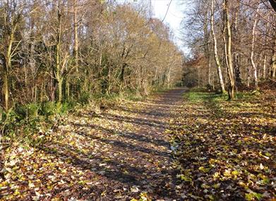
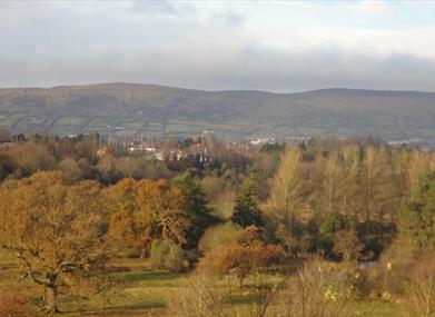
This short walk leads through Belvoir Park Forest in the south of Belfast, with views over River Lagan.Start Point:
J338690
Finish Point:
J338690
Route:
This walk proceeds from the car park at Belvoir Park Forest, Belvoir Drive. As this path is a circular walk, you are able to commence at any point on the circuit and walk in either direction. At the car park, signs are located both to your left and right hand side, please note that the following route description commences from the path on your right hand side of the car park. The beginning of this path takes you through mature trees within the wooded part of Belvoir Park Forest. As the path arrives at a natural clearing, it then veers right, leaving Belvoir Park Forest heading out towards Belvoir Drive. The route continues along Belvoir Drive, passing the Belvoir Activity Centre and Primary School. At this point the path turns right and heads back into the Forest, where again you are surrounded by lovely mature trees and depending on the season, bluebells! The path continues to take you up and around the back of the Forestry Offices, where the Headquarters of the Royal Society for the Protection of Birds is also located. The walk concludes at the car park. The route is clearly marked with designated Highway to Health signage both within the Forest and on Belvoir Drive.
Distance:
1.6 miles
Terrain:
Forest paths, some hills
Point of interest:
Belvoir Park Forest
Facilities:
Parking
Publication:
Highway to Health - Castlereagh
Publication availability:
Lisburn and Castlereagh City Council (028 9244 7622), or available to download on this page.
Nearest town:
Belfast (Castlereagh)
OS map:
Sheet 15
Book Tickets
Facilities
Provider Preferences
- Free (parking charges may apply)


