

Book Tickets Online
About
This fantastic circular walking route follows the Mourne Wall to the summit of Slieve Binnian (747m), traverses between the spectacular South and North Tors before descending along a track past the Blue Lough, Annalong Forest and back to the car park.Start Point:
J345219
Finish Point:
J345219
Route:
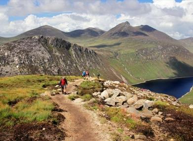
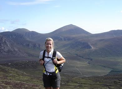
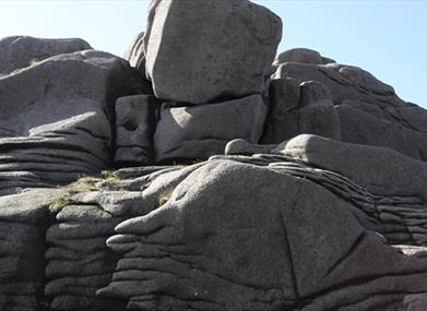
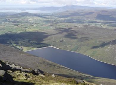
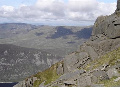
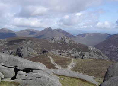
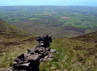
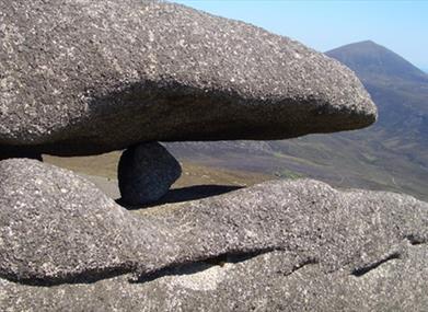
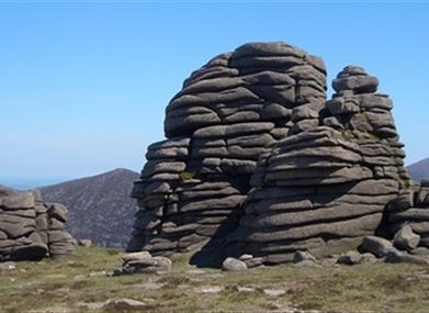
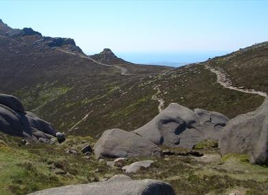
From the Carrick Little car park, follow a clear, stony track that rises gently between the fields. Note the boulder walls alongside, and the high mountains around the distant head of Annalong Valley. Cross a stone step stile beside an iron gate and turn left to follow the Mourne Wall uphill. The wall rises steeply on the rugged slopes of Slieve Binnian, but it is an obvious line to follow almost all the way to the summit. There is a break when the wall runs into a bare face of granite, and before this point you should drift to the right and aim for a notch in the top of the mountain. Going all the way to the summit at 2449ft (747m) involves using your hands and taking care on the rock. The reward is an exceedingly fine panorama of the surrounding mountain. In clear weather it's possible to see the Isle of Man out to sea and the Wicklow Mountains beyond Dublin. Pick your way carefully around the base of the Summit Tor and continue walking along the ridge of the Mountain. You cross a broken wall and follow a clear path past the Back Castles. These are a handful of wrinkly little tors that you don't have to grapple with. Simply enjoy the views as you walk past them. The North Tor is a monstrous outcrop of granite towards the end of the crest, and the path passes it on the left side. The ground slopes away more steeply as the path wanders through the heather, past boulders and outcrops of granite on the way down to a prominent gap - the col between Slieve Lamagan and Slieve Binnian. At the col turn right and follow a clear path downhill. This passes close to the Blue Lough and by keeping right at junctions with other paths, you'll be led down to a clear track passing a corner of Annalong Wood. Simply follow the track alongside the Forest fence and return to the iron gate in the Mourne Wall. Cross the wall using the stile and follow the track back to Carrick Little car park. Please be aware - although, there are numerous walking routes in the Mournes, the majority of these popular walks are not formally designated public rights of way. Most routes have developed over time due to traditional use. Below 600 feet (180m) most land is privately owned and is farmed or grazed. Many of the traditional access routes cross this land or pass along farm lanes and quarry tracks. Access is only available therefore through the tolerance and goodwill of the landowners. Walkers are advised to respect that they may be walking on private land and are encouraged to make themselves aware of and adhere to the principles of Leave No Trace' - www.leavenotraceireland.org
Distance:
7 miles
Terrain:
Tracks and mountain terrain
Point of interest:
Blue Lough and Mourne Wall
Facilities:
Toilets and refreshments available in nearby Annalong Village.
Publication:
Route 4 in a pack of walks titled - 'Mourne Mountain Walks' produced by Mourne Heritage Trust.
Publication availability:
This pack of route cards costs £5.95 and is available from a range of outlets including - Mourne Heritage Trust - 028 4372 4059 Newcastle Tourist Information Centre - 028 4372 2222 email: mht@mourne.co.uk visit www.mournelive.com
Nearest town:
Annalong Village
OS map:
Sheet 29 + Mourne Outdoor Pursuits Map (1:25,000)
Book Tickets
Facilities
Provider Preferences
- Free (parking charges may apply)


