

Book Tickets Online
About
This linear walk follows the Connswater Community Greenway along the course of three rivers that splits into two different routes - Victoria Park along the Connswater River following the route along the Knock River toMarsh-wiggle Way and Braniel, or Victoria Park along the Connswater River and following the Loop River up to Cregagh Glen. You’ll come across all sorts of wildlife and greenery to bring your walk to life.
Stop off at C.S. Lewis Square for some refreshments in EastSide Visitor Centre and explore the seven sculptures by Irish artist Maurice Harron inspired by the characters from The Lion, the Witch and the Wardrobe, before continuing your journey through Belfast’s own wildlife corridor.
Start Point:
J366750
Route:
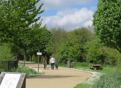
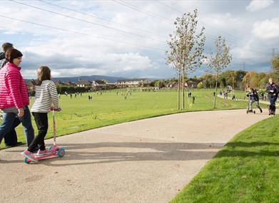
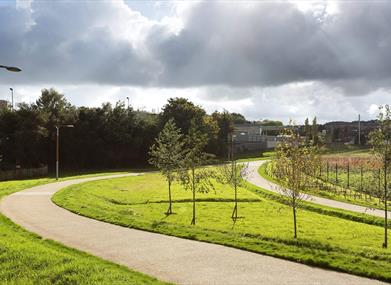
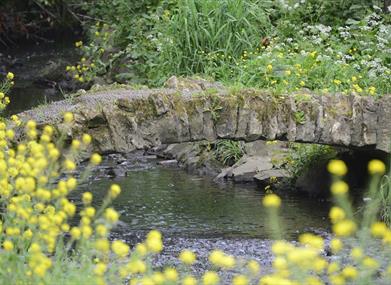
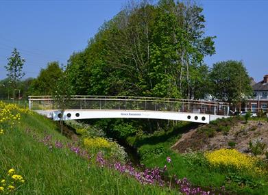
Start your walk at Victoria Park with a loop round the lake taking in the observation area and Sam Thompson Bridge. Leave via the underpass and follow the Greenway signposts. Walk up the boardwalk and across the James Ellis Bridge before you come to a pedestrian crossing at Mersey Street. Cross over and follow the pathway to C.S. Lewis Square with the option to stop and explore the seven sculptures by Irish artist Maurice Harron inspired by the characters from The Lion, the Witch and the Wardrobe. Use the pedestrian crossing beside the EastSide Visitor Centre to continue the walk along the Connswater River to Flora Street. You’ll come across a play park and possibly spot some ducks in the river. Following this path, you’ll reach another pedestrian crossing at Elmgrove Primary School/Beersbridge Road. Once across the road, the Greenway leads to the Hollow, made famous by Van Morrison. You’ll see the Conn O’Neill bridge; one of the oldest bridges in Ireland. The route across Hutchinson Bridge continues round a bend as you enter a cul-de-sac and into Dixon Playing Fields. There’s a signpost with a map detailing two options – Straight on to Orangefield Park and Marsh-wiggle Way until you reach Braniel or take the right fork to finish at Cregagh Glen. To Cregagh Glen Take the right fork walk along Orby Drive until arriving at Castlereagh Road. Crossing over at the pedestrian crossing enter the Boardwalk leading from Castlereagh Road to Ladas Way. Daddy Winker’s Play Park is situated on your right as you come to the end of the pathway. Walk through another residential area at Ladas Way (following the signposts) until you arrive at Grand Parade. Use the pedestrian crossing and continue the boardwalk over Veterans’ Bridge until you arrive at the British Legion building at the end. Taking a right, walk along Montgomery Road and then take a left onto the Cregagh Road. From here, walk to the top of the Cregagh Road, passing the Museum of Orange Heritage until you reach the Upper Knockbreda Road. Cross the road safely and you’ll arrive at Cregagh Glen. To Braniel Continuing straight along the path from the signpost, continue the walk past two more bridges; Shannon Bridge and Grace Bannister Bridge until you get to a set of traffic lights at Grand Parade. Once safely across the road enter Orangefield Park via the colourful gateway art entrance. Make your way through the park across either Avalon Bridge or Collier Bridge and follow the pathway. You might be lucky enough to spot some squirrels or foxes! Continue the path past Kingfisher Bridge and keep an eye out for the birds the bridge is named after. You might also spot a heron or egret in the Knock River which was moved from its original location as part of the £11million flood alleviation scheme. From here, continue this path passing the pond dipping area and walk up Marsh-wiggle Way, an uphill walk until you get to the end of the path at Braniel.
Distance:
Approx. 5 miles
Terrain:
Flat, wide, surfaced path
Point of interest:
Cregagh Glen, Victoria Park, C.S. Lewis Square, George Best Homeplace, Cregagh Glen
Facilities:
24hour opening Lighting Disable parking - Victoria Park Disabled toilets - Victoria Park, EastSide Visitor Centre. Wheelchair accessible café - EastSide Visitor Centre at C.S. Lewis Square Wheelchair accessible shop - EastSide Visitor Centre at C.S. Lewis Square.
Publication:
Hard copies of the Connswater Community Greenway Trail map as well as other trail maps.
Publication availability:
Available from EastSide Visitor Centre at C.S. Lewis Square and Belfast Welcome Centre.
Nearest town:
Belfast
OS map:
15
Accessible toilet facilities:
Yes


